A short
walk up the 'CUTTING' or 'Cliff Road' brings one to 'LOOKOUT' with a
wide view of the HIVE -
the local name for the beach. HIVE = hithe = a safe landing place
(or small haven).
|
| 'Lookout'
was used to look for shoals of Mackerel which was the cue for the
fishermen to get their Lerrett boats out |
|
|
Click on a picture for a more
detailed image. |
|
|
|
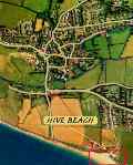
You are here |
|
 |
|
|
|
|
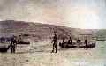
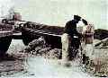
| George Swaffield and crew putting in
Herring drifts C. 1907 |
|
 |
|
|
|
|
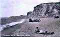
Fiishing with net or line provided
money. Special boats
called 'Lerretts' coped with the strong surf. |
|
 |
|
|
|
|
| Note cart track on cliff C. 1920
|
|
 |
|
|
|
|
| Horses and carts taking shingle off
the beach |
|
 |
|
|
|
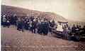
| A moment of peace as the boats, (not
the fish as shown in the picture), are blessed in an ancient
ceremony - now discontinued. |
|
 |
|
|
|
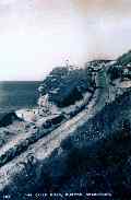
| The cliff road - providing access for
Fish and Pebble carts from the village earning income for villagers.
|
|
 |
|
|
|
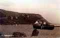
| C. 1912 Looking west |
|
 |
|
|
|
|
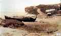
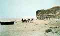
| Lerrett boat on beach C. 1925 |
|
 |
|
|
|
|
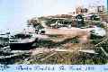
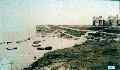
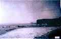
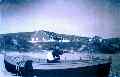
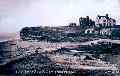
| The Hive as it was in 1918. |
|
 |
|
|
|
|
| A fisherman on the beach |
|
 |
|
|
|
|
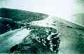
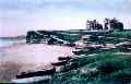
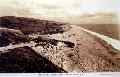
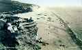
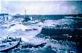
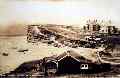
| An early view of Hive Beach |
|
 |
|
|
|
|
|
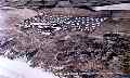
C. 1923 Seine Nets laid out on Hive Beach
|
|
 |
|
|
|
|
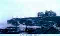
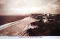
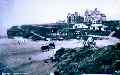
| Hive Beach 1930 |
|
|
|
|
|
|
| General view of beach
looking east |
|
 |
| |
|
|
| General view of beach
looking west |
|
 |
|
|
|
| Long distance footpaths
(South West Coast Path) in the 1890's allowed unrestricted access to
land all along the coast of South West England. So, Burton was
directly linked to 'Golden Cap', the highest point on the south
coast and beyond. |
|
 |
|
|
|
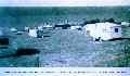
| The Old Coastguard House
caravan centre - note caravans in top field. |
|
 |
|
|
|
| This picture shows that
visitors have been holidaying here for some time. |
|
 |
|
|
|
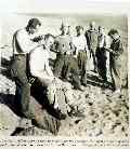
| After war was declared in
1939, and American forces arrived to train for beach landings and
cliff scaling in Normandy. The 'cliffs o' Burton were suitable
training grounds for men such as these in photo 212. |
|
 |
|
|
|
| Old Coastguard House
caravan centre - a more recent aspect of tourism - taking your
'home' with you. |
|
 |
|
|
|
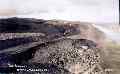
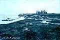
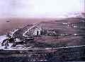
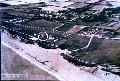
| An old aerial photograph
shows the village, 'Lookout', and the 'Hive' in relation to one
another. Beach Road is new relative to the old Cliff Road up from
the beach seen in the next photo (188). |
|
 |
|
|
|
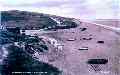
| View of Hive Beach |
|
 |
|
|
|
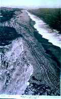
| C. 1950 Hive Beach from
the cliff heights |
|
 |
|
|
|
| Mrs Mabel Hussey braids
nets in the 'Cock of the walk' with Tom Swaffield holding the oar.
The houses on the left belonged to Mr Howarth and Dr McGregor |
|
 |
|
|
|
| C. 1945 Tom Swaffield and
Mabel Hussey |
|
 |
|
|
|
| A third change for 'The
Hive' was initiated by the construction of Beach Road, allowing
motor cars easy access to the beach. Parking is now controlled by
the National Trust, whose cafe provides the tourist with a variety
of food and drink. |
|
 |
|
|
|
| C. 1930 view of Hive Beach
|
|
 |
|
|
|
| Hive Beach looking west C.
1938 |
|
 |
|
|
|
| Carts, and later lorries,
carted shingle up Cliff Road C. 1954 |
|
 |
|
|
|
| American soldiers still
had time to prepare for the evenings, this open air salon opening
for business on the Chesil Beach at Burton Bradstock. Photograph:
Imperial War Museum |
|
 |
|
|
|
| Sunbathers on the beach
|
|
 |
|
|
|
| The beach |
|
 |
|
|
|
| Beach |
|
 |
|
|
|
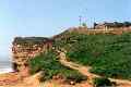
| The cliff path as you
might see it today |
|
 |
|
|
|
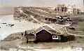
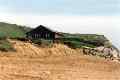
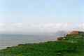
| The bungalow on Hive Beach
as you might see it today |
|
 |
|
|
|
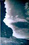
| View of Golden Cap as you
might see it today |
|
 |